Friday, November 11, 2022
Day-use reservations, park pass required at Grand Canyon north rim's Tuweep area
Sunday, November 6, 2022
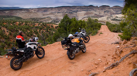
Heart of the West Adventure Route: USA's convenient multistate wildland journey
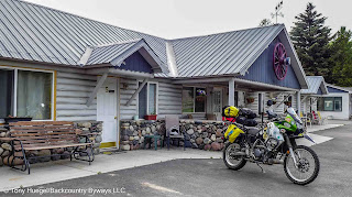
This premium service delivers convenient and customizable routing for travelers in SUVs, or on dual-sport and adventure motorcycles.
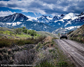
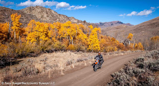
H.o.W. will remain an adaptable, GPS-guided 2,800-mile loop along backcountry roads through some of the American West's most iconic landscapes. We've also chronicled optional routing that can extend the experience far beyond H.o.W.'s core six states. Using supplementary routing, backcountry travelers can journey from Canada to Mexico, and from the Rocky Mountains to the Pacific Ocean or even the Mojave Desert for a fraction of the cost of guided trips.
Six-state 'Heart of the West Adventure Route' is even better for 2023 wildland travel
Heart of the West Adventure Route maintains its "always something new" reputation for 2023: a "Plan B" network of Rocky Mountains routes in case weather or wildfires force a change of plans.
Have a look ...
Wednesday, October 19, 2022
Cyanide leach mining: What is it? Why so dangerous? And why you pay the bill.
BISHOP, California -- To spread awareness of the threat that taxpayer-subsidized, cyanide-based gold mining poses to our use of public lands and waters, the Owens Valley-based Friends of the Inyo provides an instructive presentation on YouTube that explains cyanide leach mining.
The presenter of "The Dirty Truth About Modern Cyanide Gold Mining," Bonnie Gestring, is Northwest program director at Earthworks, a Montana conservation organization. The devastating consequences and costs born by Montana taxpayers compelled voters there to ban new cyanide leach mines in 1998.
We're sharing Gestring's talk because eastern California's rural Owens Valley and Inyo Range face the same threat as Idaho's Centennial Mountains, in rural Clark County.
As Gestring explains, industrial-scale cyanide-leach gold mining operations, like those now devastating and closing off landscapes in Nevada, are an existential threat to the American public's access to and use of Western public lands.
Monday, September 26, 2022
Start planning now for the 2023 season!
Saturday, October 2, 2021
Sierra to the Sea Adventure Route: Motoring through the wildlands of Northern California
Sierra to the Sea/Sea to Sierra Adventure Route (S2S) is our 825-mile, eight-day, GPS-guided backcountry motor route from the Sierra Nevada to the largest coastal wildland in the Lower 48, the fabled "Lost Coast."
S2S is focused on Northern California's most scenic, historic and remote unpaved backroads. The objective: To guide select overlanders, adventure motorcycle riders and other wildland travelers through some of California's wildest vehicle-accessible backcountry with data that is accurate, useful and current.
Wednesday, February 20, 2019
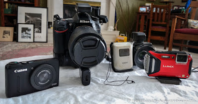
Rare GPS-equipped cameras, data loggers can precisely I.D. wildland photo locations
GPS-equipped cameras and accessories |
Wednesday, January 30, 2019
Tow strap, folding hand saw can keep forest deadfall from ending your wildland journey
Tow strap being used to move deadfall |
We've never used our 30-foot-long recovery strap for its intended purpose: hitching to a second vehicle to be extracted from a hole of some sort. We find that good judgment, used preventively, is the better tool.
We have used the strap a number of times to pull deadfall either completely out of the roadway, or far enough to make room to pass. (Why 30 feet instead of, say, 20? We find that a longer strap can probably be made shorter with wrap-arounds; but a shorter strap cannot by itself be lengthened if necessary.)
Tuesday, January 29, 2019
There is a nail waiting for a tire along every wildland road, so be ready for the inevitable
COBDR campsite where Sterling Noren's BMW got a flat tire. |
It was the second flat of the trip.
Monday, January 28, 2019
Southeastern Idaho site memorializes worst massacre of Native Americans in West
Interpretive site overlooking area of massacre |
Thursday, January 3, 2019
More than 80 years later, a byways journey reveals remnants of '30s 'Dust Bowl' country
Dust Bowl region of southeastern Colorado |
Tuesday, December 18, 2018
Backcountry Byways LLC's web address changes to 'www.backcountrybyways.com'
The change enables us to better reflect the range of premium, personalized services we've provided to wildland and overland travelers since 1993. The URL previously directed web visitors to our ground-breaking Backcountry Byways guidebook series.
Thursday, February 22, 2018
Utah's Comb Ridge, Bears Ears shelter America's ancestral-Puebloan heritage
Utah Hwy. 95 ascends the west face of Comb Ridge. |
The dramatic sandstone uplift barely survived the Republican Trump administration's downsizing of Bears Ears National Monument -- authorized by Democratic President Barack Obama -- by 85 percent in December 2017.
Wednesday, December 13, 2017
Wilco Off-Road's Hitchgate solves spare-tire issue, but poses installation, support hurdles
Wilco's Hitchgate Solo mounted on our 4Runner. |
However, the problem of where to carry a large, 70-lb. (32 kg.) or heavier second spare wheel is difficult to resolve.
We had hoped that Wilco Offroad's Hitchgate Solo spare-tire carrier was the solution. Unfortunately, two years' experience with Wilco and the Hitchgate Solo on our 4Runner leads us to recommend against the California firm's products.
Problems with Wilco and their Hitchgate include:
- the cost (upwards of $1,000 USD);
- installation and fitment problems;
- a defect in a key component of the Hitchgate;
- lack of support in overcoming that defect;
- long fulfilment times; and
- Wilco's failure to fill our order for small replacement parts (two pivot arm washers) after multiple contacts, and repeated assurances that they would promptly do so.
Monday, December 11, 2017
For SUV adventures, your smart phone or tablet can replace a dedicated GPS unit
Detailed GPX tracks make backcountry navigation easy. |
But sunlight screen readability can be a problem. (See our post on that issue.)
Sunday, December 10, 2017
Smartphones can work for adventure motorcycling, but know the pitfalls
Instead, they want to use the device they already have and use all day long: their phones, both iPhones and Android phones.
Garmin Montana (left), Samsung S5, iPhone 5 |
While our GPS data files work well on smartphones, especially when traveling in the shaded interior of an SUV, those devices can have important shortcomings when used in the daylight and the demanding conditions of adventure motorcycling.
Thursday, April 20, 2017
'Asphalt & Dirt: Life on Two Wheels'
Kindle versions are available from Amazon, and Nook versions are available from Barnes & Noble.
Give it a look!
Wednesday, May 9, 2012
Utah's anti-Moab: Green River, and the nearby San Rafael Swell and Book Cliffs
![]() |
Book Cliffs, near Green River, Utah |
With all of its warts and woes, Green River appeals to me. It is authentic Utah, and there are reasons -- access to gorgeous backcountry roads, spectacular sandstone canyons and ancient rock art -- to make Green River a destination, and to stay for a while.
Friday, May 4, 2012
Utah's Escalante country seems overlooked by Moab-bound masses -- and we're glad!
Escalante, Utah -- We may not be done with touristy Moab, but more and more we are drawn to Utah's remote, often overlooked (and underappreciated) portals to canyon country -- humble hamlets like Green River, Hanksville, Boulder and Escalante.
![]() |
Table with a view at Kiva Koffeehouse & Kottage |
Saturday, March 10, 2012
'Backcountry Discovery Route' maps for Washington, Utah rich in planning info
![]() |
Utah BDR |
![]() |
Wash. BDR |
And they're available now, in time to plan this season's backcountry ride or drive.
Butler Motorcycle Maps' information-packed Washington Backcountry Discovery Route (WABDR; 575 miles; 925 km) and Utah Backcountry Discovery Route (UTBDR; 871 miles; 1,402 km) ($14.95 ea.) can help travelers more efficiently plan full or partial trips on these two off-highway road systems.