Showing posts with label Heart of the West. Show all posts

Tuesday, December 26, 2023

Don't let weather, wildfires and work derail your wildland travels. Just ask for 'Plan B'!


As potential consolation for the risks posed by wildland travel's three dreaded "Ws" -- weather, wildfires and work -- we'll be offering 2024's clients exclusive free use of our GPS-guided "Plan B" data file with routing through the most beautiful part of Idaho, in the American West's northern Rocky Mountains.

Travel-season storms can make many of the West's dirt roads impassable. Wildfires can close backcountry roads, forcing travelers onto long highway bypasses.

Perhaps worst of all: Your phone ... and the office has your number.

For clients who suddenly must shorten or even cancel their journeys on our western wildland routes, we've compiled as compensation a free, plug-and-play GPX route file that can guide them along spectacular day trips that are second to none.

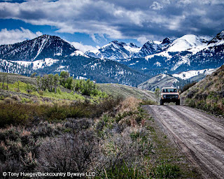
These routes -- all readily accessible from a single base -- traverse terrain that is more mineralized than clay-based, and thus more resilient to inclement conditions than many western regions.

The region is more open and less forested, and thus less prone to fire. It also is convenient to the airport and amenities of Idaho Falls, a dynamic small city just west of Wyoming and south of Montana.

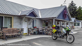
The routes can quickly be accessed from a backcountry campsite or even a rustic motel.

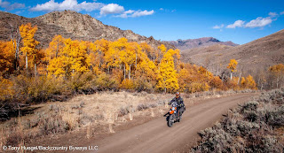
Each route is selected and documented via GPS not only for its beauty, but also for, soils that are less likely to turn to mud when wet, abundant RV and tent camping opportunities -- both dispersed and in campgrounds -- as well as lodging, alpine hiking, fishing, and mechanized trail riding, a mountain setting that is authentically Idaho, proximity to Yellowstone-Teton country, Ketchum/Sun Valley, the Sawtooth Range and ghost towns.

So be assured that if the three "Ws" find you, our "Plan B" just might save your trip -- while still providing the memorable wildland adventures you were looking for.

Contact us soon at backcountrybyways at gee mail dot com

Friday, October 6, 2023

Heart of the West Adventure Route: USA's convenient multistate wildland journey


Heart of the West Adventure Route -- the plug-and-play solution to the risks of planning an overland trip -- will continue in 2024 to provide wildland travelers a GPS-guided network of interconnected loops and routes that remains unparalleled in North America.

This premium service delivers convenient and customizable routing for travelers in SUVs, or on dual-sport and adventure motorcycles.


H.o.W. will remain an adaptable, GPS-guided 2,800-mile-plus loop along backcountry roads through some of the American West's most iconic landscapes. We've also chronicled optional routing that can extend the experience far beyond H.o.W.'s core six states. Using supplementary routing, backcountry travelers can journey from Canada to Mexico, and from the Rocky Mountains to the Pacific Ocean or even the Mojave Desert for a fraction of the cost of guided trips.

Tuesday, December 18, 2018

Backcountry Byways LLC's web address changes to 'www.backcountrybyways.com'

Backcountry Byways LLC's web address has been changed to www.backcountrybyways.com.

The change enables us to better reflect the range of premium, personalized services we've provided to wildland and overland travelers since 1993. The URL previously directed web visitors to our ground-breaking Backcountry Byways guidebook series.

Monday, December 11, 2017

For SUV adventures, your smart phone or tablet can replace a dedicated GPS unit

For easy backcountry navigation using our plug-and-play GPS data, many of our wildland-travel clients are switching from dedicated GPS units to smartphones and tablets, both Android and iOS.

Detailed GPX tracks make backcountry navigation easy.
These devices are equipped with GPS sensors, which is why Google Maps can provide directions and routing. This does not require an internet connection or cell service; it relies on GPS satellites. That makes is easy to follow the plug-and-play "tracks" we provide.

But sunlight screen readability can be a problem. (See our post on that issue.)